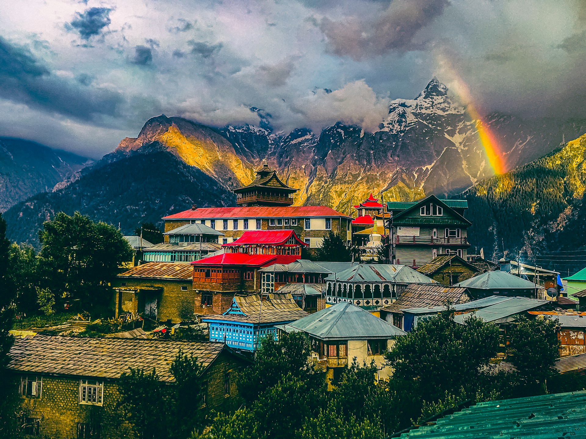
Julley, adventurous travelers!
I am Balwinder, your dedicated local tour guide, cultural storyteller, and companion across the winding, high-altitude roads of Himachal Pradesh. If you have ever dreamed of leaving behind the chaos of urban life to stand face-to-face with peaks that scrape the sky, taste crisp apples straight from a high-mountain orchard, or watch prayer flags flutter against a stark, high-altitude cold desert, then you have arrived at the right place.
The mountains are calling, and they are whispering secrets of ancient monasteries, legendary passes, and emerald lakes. This is not just a holiday; it is a life-altering pilgrimage through the raw, unfiltered heart of Kinnaur and Spiti Valley.
Through this comprehensive guide, I will take you on a sensory preview of our meticulous 8-Day Master Circuit from Shimla to Manali. By the time you reach the end of this journey, you won’t just want to see these places—you will feel an irresistible pull to experience them.
Let’s turn that wanderlust into reality. To secure your customized, hassle-free private expedition with a seasoned crew, reach out directly to me at balwindertourguide222@gmail.com. Your seat in our mountain-ready 4×4 is waiting!
Why You Must Explore This Circuit with a Professional Guide
The Kinnaur and Spiti loops are famously rewarding, but they are equally demanding. This is an environment where the roads transform from smooth asphalt to rugged, boulder-strewn tracks carved directly into vertical cliffs. The geography demands respect, local know-how, and impeccable logistics.
[Shimla] ➔ [Sangla / Chitkul] ➔ [Kalpa] ➔ [Tabo / Dhankar] ➔ [Kaza] ➔ [Chandratal] ➔ [Manali]
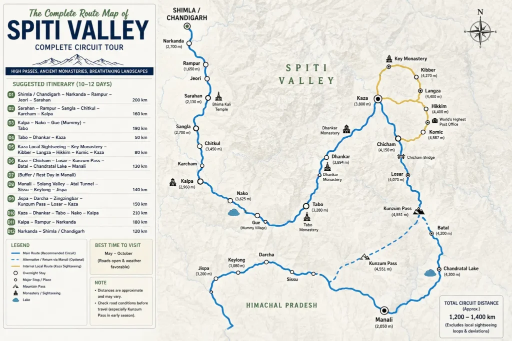
The Master Route Map: An Overview of the Loop
Our route is carefully designed to trace a perfect geographical and cultural arc. We begin in the colonial foothills of Shimla, move through the dense green valleys and apple orchards of Kinnaur, cross over into the stark, lunar-like cold deserts of Spiti Valley, and finish through engineering marvels and alpine forests into Manali.
Shimla ➔ Narkanda ➔ Rampur Bushahr ➔ Karcham ➔ Sangla ➔ Chitkul ➔ Reckong Peo ➔ Kalpa ➔ Pooh ➔ Khab ➔ Nako ➔ Chango ➔ Gue ➔ Tabo ➔ Schichling ➔ Dhankar ➔ Attargo Bridge ➔ Mud Village (Pin Valley) ➔ Kaza ➔ Langza ➔ Hikkim ➔ Komik ➔ Rangrik ➔ Chicham Bridge ➔ Losar ➔ Kunzum Pass ➔ Batal ➔ Chandratal ➔ Chhatru ➔ Gramphu ➔ Atal Tunnel ➔ Solang Valley ➔ Manali
This specific direction ensures a gradual, safe acclimatization curve, allowing your body to adapt naturally to the dramatic changes in elevation.
Detailed Day-by-Day Expedition Itinerary
Day 1: The Gateway to Kinnaur – Shimla to Sangla & Kalpa
- The Route: Shimla Narkanda Rampur Bushahr Karcham (diversion for Sangla) Sangla Kalpa
- Distance / Time: Approx. |
- Elevation Profile: Starting at in Shimla, descending to the Sutlej valley floor, and ascending to at Kalpa.
Our journey kicks off early from the historic hill station of Shimla. As we leave behind the bustling mall road, the air grows rapidly crisper. We wind our way through Narkanda, surrounded by dense fir and spruce forests, where winter skiing slopes give way to beautiful summer greenery.
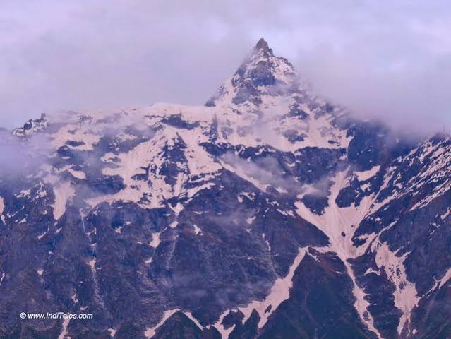
The Sacred Kinner Kailash Range from Kalpa. Source: Inditales
As we hit the Hindustan-Tibet highway, the landscape shifts dramatically. The roads are carved directly into rock walls, forming massive overhangs. Below us, the fierce Sutlej River crashes through deep gorges. At Karcham, we cross the massive dam site and turn into the Sangla Valley, also known as the Baspa River Valley. This is one of the most beautiful green valleys in the Himalayas, lined with traditional wooden houses and vast orchards of world-renowned Kinnauri apples, apricots, and walnuts.
After a short break amid these terraced fields, we climb up towards the historic village of Kalpa for a relaxing evening.
Day 2: The Last Village of India – Sangla to Kalpa via Chitkul Detour
- The Route: Kalpa Sangla Rakcham Chitkul Return to Karcham Reckong Peo Kalpa
- Distance / Time: Approx. direct | Around total with the Chitkul detour | driving time
- Elevation Milestone: Chitkul rests at a staggering .
Today is all about exploring the hidden cultural treasures of Kinnaur. We trace our path along the Baspa River back towards Chitkul, the very last inhabited village near the Indo-Tibet border. Along the way, we make several key stops:
- Kamru Fort: Perched high above Sangla, this ancient wooden fortress is a striking example of Kinnauri tower architecture. It houses a revered shrine to the goddess Kamakhya Devi.
- Batseri Village: A pedestrian-only wooden hamlet where locals still craft traditional woolens. Walking through its narrow stone-paved lanes feels like stepping back in time.
- Chitkul Village: Famous for its incredibly crisp air and fairytale log cabins. We will visit the Chitkul Mata Temple, featuring intricate wooden carvings that fuse Hindu and Buddhist artistry.
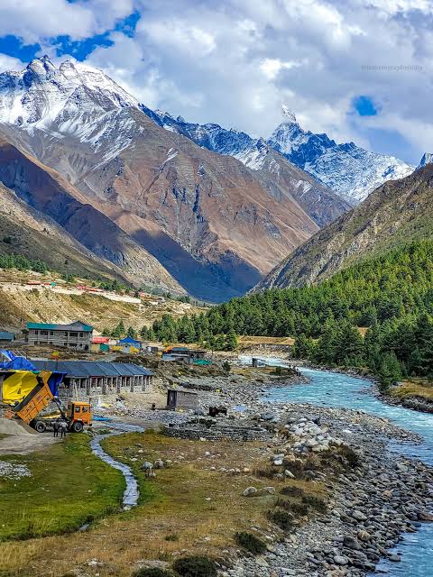
Chitkul – The Final Inhabited Frontier. Source: Raacho Trekkers
After a lunch of local Himalayan trout or a hot bowl of mountain noodles near the riverbank, we head up to Kalpa. As evening falls, you will enjoy front-row views of the sunset illuminating the sacred Kinner Kailash Range. Watch the light turn the peak’s famous natural rock Shiva Lingam into a brilliant shade of gold.
Day 3: Crossing the Border into the Cold Desert – Kalpa to Tabo
- The Route: Kalpa Reckong Peo Pooh Khab Nako Chango Gue Tabo
- Distance / Time: Approx. |
- Geographical Transition: Leaving the green forests of Kinnaur for the rain-shadow region of Spiti.
We start early today as the terrain changes completely. As we drive past Pooh, the lush green mountain slopes drop away, replaced by bare, towering rock walls of brown, orange, and deep grey.
Our first major stop is Khab Sangam, the dramatic, roaring confluence where the muddy waters of the Spiti River meet the fast-flowing Sutlej River. From here, a series of steep hairpin turns brings us up to Nako Village. Situated around a high-altitude lake, Nako features traditional mud-brick houses, ancient prayer wheels, and a th-century monastery.
[Kinnaur Valleys] ➔ Khab Confluence ➔ [Spiti Cold Desert]
Next, we take a short detour into the remote valley of Gue Village. Hidden inside an insulated glass enclosure here is one of the world’s most unique anomalies: the naturally preserved, 500-year-old mummy of Buddhist monk Sangha Tenzin.
Local tradition tells us he began mummifying himself while still alive through a deep meditative ritual known as Sokushinbutsu, timing it with a local drought to protect his village. The mummy still has intact hair, skin, and teeth without any chemical preservation. We finish the day’s journey by driving along the riverbed to the historic town of Tabo.
Day 4: Sentinels of the Cliffs – Tabo to Kaza
- The Route: Tabo Schichling (diversion for Dhankar) Dhankar Attargo Bridge Mud Village (Pin Valley) Kaza
- Distance / Time: Approx. (including detours) |
- Cultural Hub: Arriving at Kaza, the administrative headquarters of Spiti Valley.
We begin our morning at the Tabo Monastery complex, often called the “Ajanta of the Himalayas.” Founded in by the great scholar Rinchen Zangpo, it is the oldest continuously functioning Buddhist monastery in India.
Inside its dark, clay-walled halls are beautifully preserved murals, stucco statues, and ancient manuscripts. Above the complex are a series of ancient meditation caves carved directly into the cliffside, where monks still retreat for months of silent contemplation.
[Dhankar Monastery] – Perched on a crumbling cliff
|
v
[Attargo Bridge] ➔ [Pin Valley National Park] ➔ [Kaza]
Leaving Tabo, we head up to Dhankar Monastery, a spectacular complex built directly onto a sharp, crumbling mud cliff looking down at the meeting point of the Spiti and Pin rivers.
We then cross the iconic Attargo Bridge to explore Pin Valley National Park. This region features a raw, stark landscape with icy rivers and unique rock formations. It is also a safe haven for rare high-altitude wildlife like the endangered snow leopard, Siberian ibex, and the red fox.
After visiting Mud Village—the last outpost in Pin Valley—we make our way to Kaza for the night.
Day 5: The High-Altitude Circuit – Kaza Local Excursion
- The Route: Kaza Langza – Hikkim – Komik – Kaza
- Distance / Time: Approx. total loop | Full-day excursion | total driving
- Elevation Peak: Reaching an altitude of above sea level.
Today we explore the highest motorable villages in the world, tucked away in the mountain valleys above Kaza.
Our first stop is Langza, famous for the giant, colorful Buddha statue that sits looking out across the valley against a backdrop of snow-covered peaks. Langza is also known as the fossil village of India; millions of years ago, this entire region sat at the bottom of the prehistoric Tethys Ocean. With a bit of luck, you can find small marine fossils, known locally as Chaudua, embedded right in the stones along the paths.
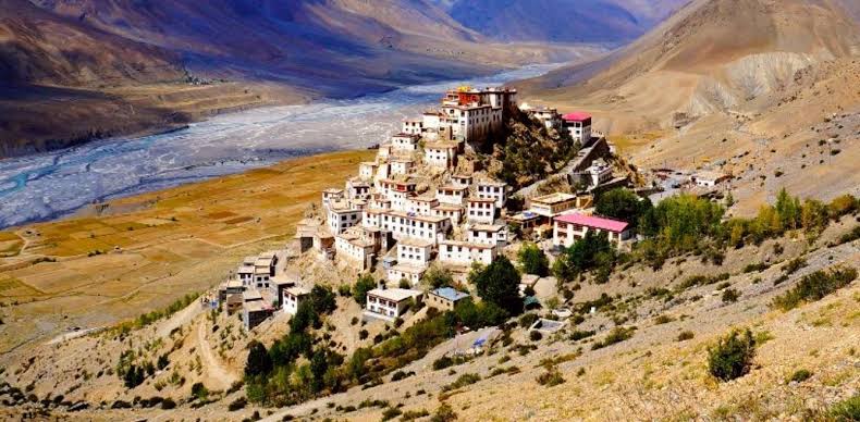
Kaza – The Heart of Spiti Valley. Source: Travel and Leisure Asia
Next, we drive over to Hikkim, home to the world’s highest post office at . Here, we will take some time to write postcards to your loved ones and stamp them at this remote outpost.
Finally, we head up to Komik, one of the highest villages on earth connected by a motorable road (). We will visit the ancient Lundup Tshemo Gompa here, experience the slow pace of local life, and enjoy a hot tea at the highest eco-kitchen on the planet before heading back down to Kaza.
Day 6: Over the High Passes to Moon Lake – Kaza to Chandratal
- The Route: Kaza Rangrik Chicham Bridge Losar Kunzum Pass Batal Chandratal Camping Ground
- Distance / Time: Approx. | (unpaved, rocky terrain)
- The Challenge & Reward: Navigating high-altitude dirt tracks to sleep beneath a blanket of stars.
This is often the most highly anticipated day of the entire trip. We start by crossing the famous Chicham Bridge, a striking suspension bridge built across a deep, canyon that links the isolated village of Chicham to the rest of the valley.
From there, we follow the riverbed past Losar, the final checkpoint in Spiti, before starting our steep climb up the dramatic Kunzum Pass ().
Local Custom: Following ancient mountain tradition, our driver will circle the colorful Kunzum Mata Temple at the top of the pass to ask for safe passage before we begin the descent into the Chandra River valley.
[Kaza] ➔ Chicham Bridge ➔ Kunzum Pass (4,551m) ➔ Batal ➔ [Chandratal]
From the small outpost of Batal, we navigate a narrow, rocky track that leads directly to Chandratal, the legendary “Moon Lake.” Perched at , this crescent-shaped body of water is famous for its striking color, shifting throughout the day from deep turquoise to shimmering emerald and bright blue.
Vehicles stop at a designated parking area, followed by a short, easy walk to the water’s edge. To preserve this delicate ecosystem, our cozy campsites are located in a wide valley below the lake, offering an unforgettable night under a clear sky filled with stars and the Milky Way.
Day 7: Engineering Marvels & Alpine Valleys – Chandratal to Manali
- The Route: Chandratal Camps Batal Chhatru Gramphu Atal Tunnel Solang Valley Manali
- Distance / Time: Approx. |
- Terrain Insight: The stretch from Batal to Gramphu is a rugged dirt and boulder track requiring high clearance and experienced driving.
We start our morning with a drive along the rugged riverbed of the Chandra River, passing through the isolated outposts of Chhatru and Gramphu. This road is an adventurer’s dream, filled with glacial streams crossing the track, gravel sections, and grand views of the surrounding glaciers.
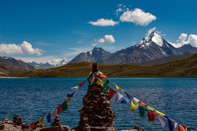
The Ethereal Waters of Chandratal Lake. Source: JustWravel
Everything changes as we reach the entrance of the Atal Tunnel. This engineering marvel is the longest highway tunnel in the world above , cutting right through the solid rock of the Pir Panjal range.
In just ten minutes, you leave the dry, rocky landscapes of the cold desert behind and emerge into the lush green forests and alpine meadows of the Solang Valley. Known as the adventure capital of the region, Solang offers a variety of sports like paragliding and zorbing. From there, it’s a short, smooth drive down to the bustling town of Manali.
Day 8: Cultural Highlights & Evening Departure
- The Route: Local Manali Sightseeing Manali Volvo Bus Stand
- Final Day Wrap-up: Relaxed sightseeing before your comfortable overnight bus journey home.
On our final day together, we take a relaxed look at the rich culture and history of Manali:
- Hadimba Temple: Built in , this historic four-tiered wooden pagoda temple sits inside a dense forest of towering deodar cedars. It is dedicated to Goddess Hadimba from the Indian epic, the Mahabharata.
- Vashisht Village: Famous for its natural hot sulfur springs. The traditional stone temples here feature dedicated public bathing areas where you can relax after days on the mountain roads.
- Old Manali: A bohemian neighborhood filled with traditional wooden houses, small handicraft shops, and lively cafes serving fresh wood-fired pizzas and local apple cider.
In the afternoon, you can pick up some local souvenirs like handmade Kullu shawls, organic saffron, or dried shilajit. As evening approaches, I will drop you off at the Manali Volvo stand for your comfortable overnight journey home, bringing a magical journey through the Himalayas to a close.
High-Altitude Preparation & Packing Guide
Safety is our number one priority on every expedition. Traveling from the lower hills of Shimla to high wilderness zones like Kunzum Pass and Chandratal requires careful preparation to prevent Acute Mountain Sickness (AMS).
Acclimatization Rules
- Hydrate Constantly: Drink 4–5 liters of water daily. The high-altitude air is dry, and your lungs work harder.
- Avoid Alcohol and Smoking: These accelerate dehydration and mask early symptoms of AMS.
- Eat Light: High altitudes slow down digestion; stick to simple, carb-rich mountain meals.
- Rest Day 3 & 4: Let your body naturally adapt as we transition into Tabo and Kaza.
Recommended Clothing Layering System
To stay comfortable through dramatic temperature shifts, use a simple three-layer clothing system:
- Base Layer: Moisture-wicking thermal tops and bottoms.
- Mid Layer: A warm fleece sweater or light down jacket to trap body heat.
- Outer Layer: A sturdy, windproof and waterproof jacket to protect against cold mountain winds.
- Essentials: Sturdy trekking shoes with good grip, woolen socks, a warm beanie, UV-protection sunglasses, and a high-SPF sunscreen.
Secure Your Private Himalayan Expedition Today!
This iconic loop from the green valleys of Kinnaur to the ancient cliffs of Spiti is more than just a road trip—it is an unforgettable journey through some of the grandest landscapes on earth.
Planning a trip to these high-altitude regions requires deep local knowledge, dependable transport, and trusted connections for stays in remote villages. My team and I are dedicated to bringing you an authentic, safe, and deeply immersive mountain experience.
Get in Touch: For detailed quotes, customized itineraries, and group bookings, drop me a line directly at: balwindertourguide222@gmail.com